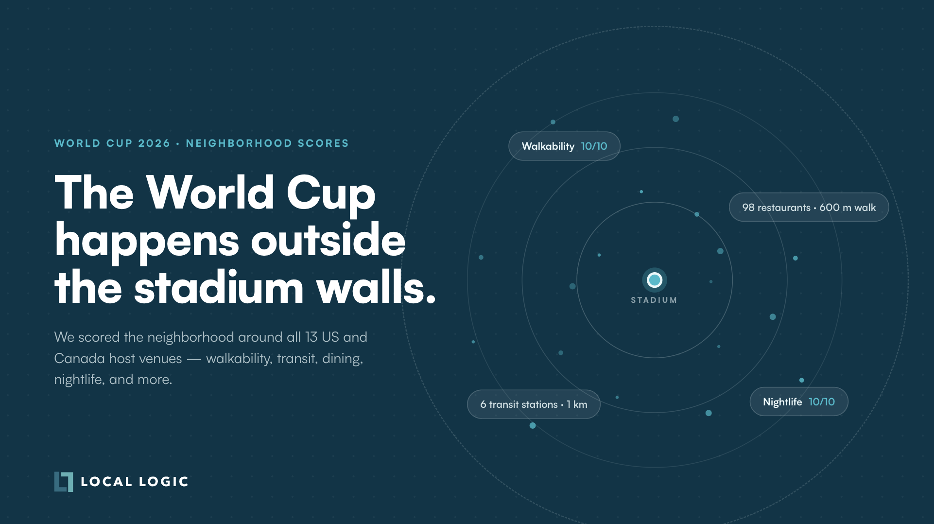
The 2026 World Cup Happens Outside the Stadium Walls
Insights
| 11 Jun 2026
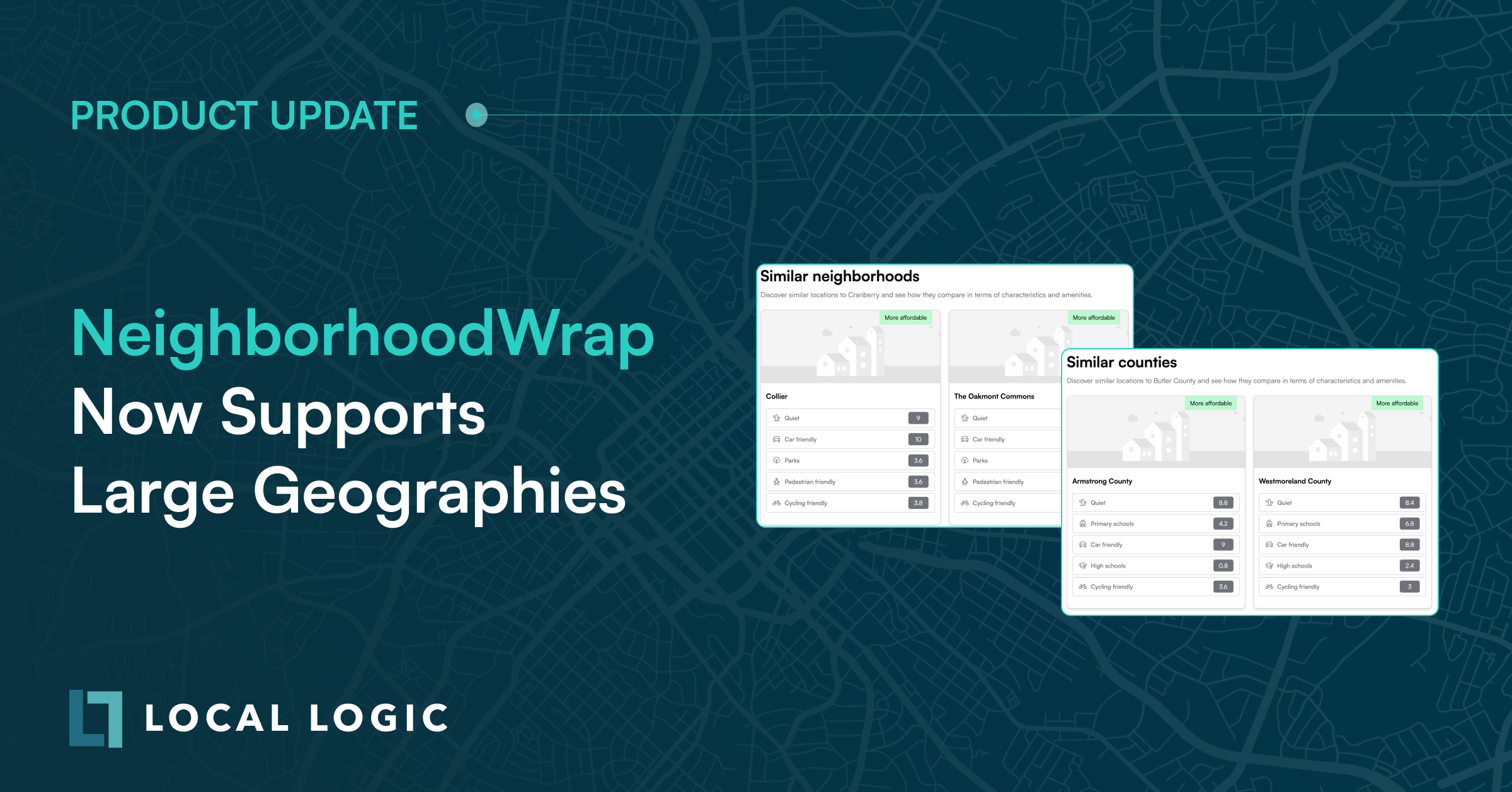
NeighborhoodWrap helps you bring the full context of a location, from neighborhood character and points of interest to schools and demographics, to life for home consumers through dynamic, data-rich community pages.
Today, we’re excited to announce a set of updates that allows NeighborhoodWrap to support larger geographies, such as cities and counties.
These improvements were built in direct response to a growing number of customers choosing to implement NeighborhoodWrap at larger geography levels. When the geography changes, NeighborhoodWrap should change with it, from the language it uses, to the number of points of interest it highlights, to the school data it displays.
Here’s what’s new:
One of the most important changes in this update is how NeighborhoodWrap handles language across different geography types.
NeighborhoodWrap has always been built around the richness of neighborhood-level context, which works well for most implementations. But as more customers implement the product across cities and counties, the language used needs to match the scale of the geography being explored.
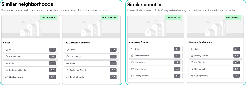
Language throughout NeighborhoodWrap now updates dynamically based on the geography level. Where it previously read “neighborhood,” the product now recognizes whether a consumer is viewing a neighborhood, city, or county, and adjusts its language accordingly throughout the experience.
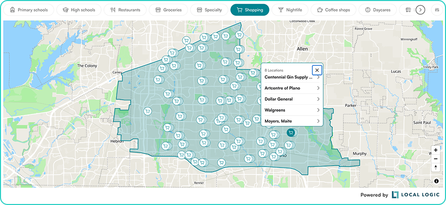
The maximum number of points of interest displayed in each category on NeighborhoodMap has been increased from 30 to 500 to better reflect the breadth of services and amenities available.
For dense geographies like a major city or a large suburban county, this means consumers now see a far more complete and representative picture of what’s nearby, from restaurants and parks to transit and retail.
We’ve also improved the algorithm for locating points of interest within a geography to ensure that results always fall within or near the geography’s boundaries.
Alongside the points of interest expansion, schools have been updated to better serve consumers exploring larger geographies.
NeighborhoodWrap now displays up to 30 primary schools and 30 secondary schools, up from a previous maximum of 10 schools total. For a county or city with dozens of schools across multiple towns, this increase meaningfully expands the scope of what consumers can see and compare.
Two additional enhancements make that larger selection of schools easier to navigate:
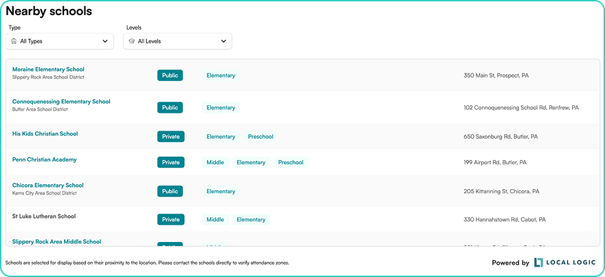
Full addresses are now shown to help consumers better locate schools that may fall within multiple towns across a county or city.
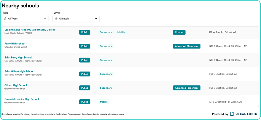
Schools offering Magnet programs, Charter school status, or Advanced Placement tracks are now labeled accordingly in the school list. This gives consumers a clearer view of the educational landscape in their target area, beyond basic rankings or proximity.
Ready to tell better location stories at scale?
Schedule a personalized walkthrough to see how large geography support in NeighborhoodWrap can strengthen your platform and workflows.